Geolocate

Old Town topographic map

Click on the map to display elevation.

About this map
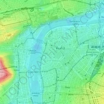
Name: Old Town topographic map, elevation, terrain.

Location: Old Town, obvod Praha 1, Prague, Czechia (50.07867 14.40898 50.09429 14.42847)

Average elevation: 215 m

Minimum elevation: 177 m

Maximum elevation: 322 m

Other topographic maps

Click on a map to view its topography, its elevation and its terrain.

Krteň

Czechia > Prague

Average elevation: 359 m

Gear up for your next adventure:

🧥Softshell Jacket - Windproof and breathable jacket for hiking
🥾All-Terrain Hiking Boots - Versatile boots for varied hiking conditions
🧤Insulated Winter Gloves - Heavy-duty protection for sub-zero Canadian adventures
👟Sport Hiking Sandals - Breathable footwear for water crossings and camp rest
🧢Hiking Sun Hat - Wide-brimmed protection for exposed mountain ridges

As an Amazon Associate, this site earns from qualifying purchases at no extra cost to you.