Geolocate

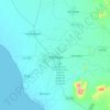
Chiclayo topographic map

Click on the map to display elevation.

About this map

Name: Chiclayo topographic map, elevation, terrain.

Location: Chiclayo, Province of Chiclayo, Lambayeque, Peru (-6.83260 -79.87229 -6.73985 -79.78012)

Average elevation: 28 m

Minimum elevation: 13 m

Maximum elevation: 61 m

Other topographic maps

Click on a map to view its topography, its elevation and its terrain.

Co1

Peru > Lambayeque > José Leonardo Ortiz

Average elevation: 36 m

Chiclayo

Peru > Lambayeque

Average elevation: 39 m

Mayascón

Peru > Lambayeque

Average elevation: 402 m

Los Jagueyes de Mayascón

Peru > Lambayeque > Pítipo

Average elevation: 555 m

Morrope

Peru > Lambayeque > Mórrope

Average elevation: 19 m

Mocupe

Peru > Lambayeque

Average elevation: 35 m

C

Peru > Lambayeque > Chiclayo

Average elevation: 24 m

Gear up for your next adventure:

⛺Camping Groundsheet - Protect your tent from moisture and dirt
🧰Multitool Knife - Compact and versatile tool for outdoor use
🚲Heavy Duty Bike Lock - Secure your bike at the trailhead or during stops
🧤Rechargeable Heated Gloves - Extreme warmth for Canadian winter expeditions
💡Portable Camping Lamp - Rechargeable lamp for campsite lighting

As an Amazon Associate, this site earns from qualifying purchases at no extra cost to you.