Geolocate

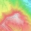
Unteriberg topographic map

Click on the map to display elevation.

About this map

Name: Unteriberg topographic map, elevation, terrain.

Location: Unteriberg, Schwyz, Switzerland (47.00242 8.76144 47.07999 8.88890)

Average elevation: 1,346 m

Minimum elevation: 885 m

Maximum elevation: 2,269 m

Other topographic maps

Click on a map to view its topography, its elevation and its terrain.

Stoos

Switzerland > Schwyz > Schwyz

Average elevation: 1,232 m

Rigi

Switzerland > Schwyz > Schwyz > Arth

Average elevation: 1,266 m

Brunnen

Switzerland > Schwyz > Schwyz

Average elevation: 592 m

Rickenbach bei Schwyz

Switzerland > Schwyz > Schwyz > Schwyz

Average elevation: 751 m

Ibach

Switzerland > Schwyz > Schwyz > Schwyz

Average elevation: 555 m

Mythen

Switzerland > Schwyz > Schwyz > Schwyz

Average elevation: 1,219 m

Bös Fulen

Switzerland > Schwyz > Schwyz > Muotathal

Average elevation: 2,206 m

Rigi First

Switzerland > Schwyz > Schwyz > Arth

Average elevation: 1,198 m

Chäppeliberg

Switzerland > Schwyz > Schwyz > Schwyz

Average elevation: 1,115 m

Rickenbach

Switzerland > Schwyz > Schwyz > Schwyz

Average elevation: 751 m

Gear up for your next adventure:

🏃Hydration Running Vest - Carry water and maps close to your body for speed
🛏️Camping Sleeping Mat - Comfortable mats for sleeping outdoors
🧥Fleece Jacket - Warm and lightweight jacket for layering
🥾Mountain Trail Shoes - High-traction shoes for mountain trails
🎒Backpack Rain Cover - External shield to keep your entire pack dry

As an Amazon Associate, this site earns from qualifying purchases at no extra cost to you.