Geolocate

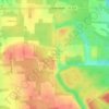
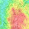
Austintown topographic map

Click on the map to display elevation.

About this map
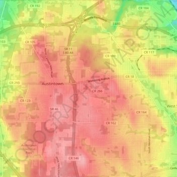
Name: Austintown topographic map, elevation, terrain.

Location: Austintown, Austintown Township, Mahoning County, Ohio, 44515, United States (41.06105 -80.79385 41.13387 -80.71101)

Average elevation: 321 m

Minimum elevation: 272 m

Maximum elevation: 361 m

Other topographic maps

Click on a map to view its topography, its elevation and its terrain.
Austintown

United States > Ohio > Mahoning County

Average elevation: 318 m

New Springfield

United States > Ohio > Mahoning County

Average elevation: 358 m

Lake Milton

United States > Ohio > Mahoning County

Average elevation: 299 m

Poland Center

United States > Ohio > Mahoning County

Average elevation: 336 m

Austintown

United States > Ohio > Mahoning County

Average elevation: 318 m

North Jackson

United States > Ohio > Mahoning County

Average elevation: 311 m

North Lima

United States > Ohio > Mahoning County

Average elevation: 336 m

Stony Ridge

United States > Ohio > Mahoning County > Austintown

Average elevation: 310 m

Uptown

United States > Ohio > Mahoning County > Youngstown

Average elevation: 314 m

Fosterville

United States > Ohio > Mahoning County > Youngstown

Average elevation: 313 m

Gear up for your next adventure:

🛶Kayak Dry Bag - Waterproof storage for kayaking adventures
🛏️Camping Sleeping Mat - Comfortable mats for sleeping outdoors
💧Collapsible Water Bottle - Space-saving water bottle for outdoor activities
💧Hydration Pack - Hands-free hydration system for long hikes
🥾All-Terrain Hiking Boots - Versatile boots for varied hiking conditions

As an Amazon Associate, this site earns from qualifying purchases at no extra cost to you.