Geolocate

Uptown topographic map

Click on the map to display elevation.

About this map

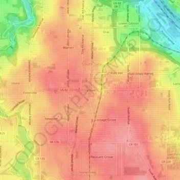
Name: Uptown topographic map, elevation, terrain.

Location: Uptown, Youngstown, Mahoning County, Ohio, 44507, United States (41.05251 -80.67752 41.09251 -80.63752)

Average elevation: 314 m

Minimum elevation: 251 m

Maximum elevation: 342 m

Other topographic maps

Click on a map to view its topography, its elevation and its terrain.

Gear up for your next adventure:

Lightweight Camping Tent - Portable shelter optimized for Canadian backcountry camping
🔨Vehicle Emergency Tool - Safety tool for remote road trips to trailheads
🧦Crew Hiking Socks - Comfortable socks for long-distance hikes
🥾Trail Running Boots - Durable shoes designed for trail running
🦌Outdoor Trail Camera - Monitor wildlife activity near your favorite spots

As an Amazon Associate, this site earns from qualifying purchases at no extra cost to you.