Geolocate

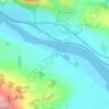
Horn topographic map

Click on the map to display elevation.

About this map

Name: Horn topographic map, elevation, terrain.

Location: Horn, Perth, Perth and Kinross, Scotland, PH2 7SR, United Kingdom (56.40293 -3.23867 56.44293 -3.19867)

Average elevation: 19 m

Minimum elevation: 7 m

Maximum elevation: 167 m

Other topographic maps

Click on a map to view its topography, its elevation and its terrain.

Gear up for your next adventure:

🧴Waterproofing Spray - Restore the DWR coating on jackets and tents
🧢Outdoor Cap - Protective cap for sun and rain during hikes
🔋Lithium AA Batteries - Long-lasting power that performs in extreme cold
🥾Trail Hiking Socks - Comfortable socks to prevent blisters and fatigue
👖Convertible Hiking Pants - Zip-off legs to adapt to changing weather conditions

As an Amazon Associate, this site earns from qualifying purchases at no extra cost to you.