Geolocate

Parrish topographic map

Click on the map to display elevation.

About this map

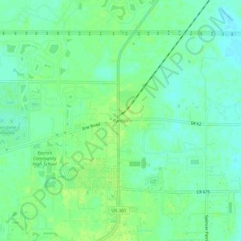
Name: Parrish topographic map, elevation, terrain.

Location: Parrish, Manatee County, Florida, 34219, United States (27.56754 -82.44509 27.60754 -82.40509)

Average elevation: 12 m

Minimum elevation: 5 m

Maximum elevation: 17 m

Other topographic maps

Click on a map to view its topography, its elevation and its terrain.

Longboat Key

United States > Florida > Manatee County

Average elevation: 1 m

Holmes Beach

United States > Florida > Manatee County

Average elevation: 1 m

Memphis

United States > Florida > Manatee County > Memphis

Average elevation: 5 m

Memphis

United States > Florida > Manatee County > Memphis

Average elevation: 6 m

Gear up for your next adventure:

🥾Mountain Trail Shoes - High-traction shoes for mountain trails
🚲Handlebar Phone Mount - View topographic-map.com live while cycling
🧰Multitool Knife - Compact and versatile tool for outdoor use
🛁Quick-Dry Microfiber Towel - Space-saving towel that dries rapidly on the move
🧭Orienteering Kit - Tools for map reading and navigation in the wild

As an Amazon Associate, this site earns from qualifying purchases at no extra cost to you.