Geolocate

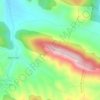
Ansó topographic map

Click on the map to display elevation.

About this map

Name: Ansó topographic map, elevation, terrain.

Location: Ansó, Jacetania, Huesca, Aragon, 22728, Spain (42.63476 -0.86295 42.92450 -0.55121)

Average elevation: 1,183 m

Minimum elevation: 513 m

Maximum elevation: 2,637 m

Other topographic maps

Click on a map to view its topography, its elevation and its terrain.
Candanchú

Spain > Aragon > Jacetania > Aísa

Average elevation: 1,686 m

Llena del Aspe

Spain > Aragon > Jacetania > Ansó

Average elevation: 2,190 m

Torla

Spain > Aragon > Jacetania > Santa Cruz de la Serós

Average elevation: 840 m

Badaguás

Spain > Aragon > Jacetania > Jaca

Average elevation: 1,100 m

Hecho

Spain > Aragon > Jacetania > Valle de Hecho

Average elevation: 967 m

Hecho

Spain > Aragon > Jacetania > Valle de Hecho

Average elevation: 967 m

Gear up for your next adventure:

🛏️Camping Sleeping Mat - Comfortable mats for sleeping outdoors
🧰Survival Kit - Essential gear for emergencies in the wilderness
🧭GPS Tracker - Track your location in remote areas safely
🧥Softshell Hiking Jacket - The perfect balance of wind protection and breathability
💡LED Camping Lantern - Illuminate your campsite with long-lasting lanterns

As an Amazon Associate, this site earns from qualifying purchases at no extra cost to you.