Geolocate

Badaguás topographic map

Click on the map to display elevation.

About this map

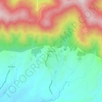
Name: Badaguás topographic map, elevation, terrain.

Location: Badaguás, Jaca, Jacetania, Huesca, Aragon, 22714, Spain (42.56534 -0.48554 42.60534 -0.44554)

Average elevation: 1,100 m

Minimum elevation: 864 m

Maximum elevation: 1,493 m

Gear up for your next adventure:

🧢Beanie Hat - Keep your head warm in cold weather
🌬️Windproof Camp Stove - Efficient cooking even on exposed mountain peaks
🎒Hiking Daypack - Lightweight and durable backpacks for day trips and excursions
🚑Survival Whistle - Signal for help across long distances in mountains
🔋Solar Power Bank - Keep your GPS and devices charged during long outdoor trips

As an Amazon Associate, this site earns from qualifying purchases at no extra cost to you.