Geolocate

Grand-Remous topographic map

Click on the map to display elevation.

About this map

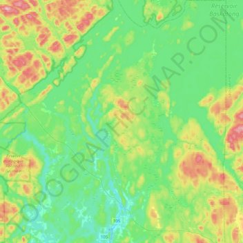
Name: Grand-Remous topographic map, elevation, terrain.

Location: Grand-Remous, La Vallée-de-la-Gatineau, Outaouais, Quebec, J0W 1E0, Canada (46.57597 -76.01202 46.84489 -75.74695)

Average elevation: 244 m

Minimum elevation: 175 m

Maximum elevation: 419 m

La Vallée-de-la-Gatineau trails, hiking, mountain biking, running and outdoor activities

Other topographic maps

Click on a map to view its topography, its elevation and its terrain.

Fieldville

Canada > Quebec > La Vallée-de-la-Gatineau > Low

Average elevation: 171 m

Lac Rond

Canada > Quebec > La Vallée-de-la-Gatineau > Denholm

Average elevation: 277 m

Lac Hughes

Canada > Quebec > La Vallée-de-la-Gatineau > Denholm

Average elevation: 272 m

Lac Shea

Canada > Quebec > La Vallée-de-la-Gatineau > Kazabazua

Average elevation: 183 m

Venosta

Canada > Quebec > La Vallée-de-la-Gatineau > Low

Average elevation: 171 m

Gear up for your next adventure:

🧰Survival Kit - Essential gear for emergencies in the wilderness
🥘Camping Cookware Set - Compact nesting pots and pans for trail cooking
🍽️Titanium Camping Spork - Ultralight and indestructible eating utensil
🥾Mountaineering Boots - Supportive boots for climbing and high-altitude hiking
🩹Compact First Aid Kit - Pre-packed essentials for common trail injuries

As an Amazon Associate, this site earns from qualifying purchases at no extra cost to you.