Geolocate

Ferme-Joseph topographic map

Click on the map to display elevation.

About this map

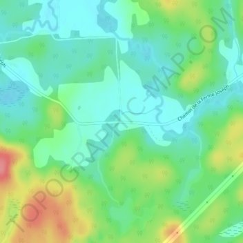
Name: Ferme-Joseph topographic map, elevation, terrain.

Location: Ferme-Joseph, Déléage, La Vallée-de-la-Gatineau, Outaouais, Quebec, Canada (46.40227 -75.82595 46.42227 -75.80595)

Average elevation: 210 m

Minimum elevation: 183 m

Maximum elevation: 267 m

La Vallée-de-la-Gatineau trails, hiking, mountain biking, running and outdoor activities

Gear up for your next adventure:

🧢Sun Protection Cap - Breathable cap to protect from sun exposure
🕯️Camping Lantern - Illuminates your entire campsite with high-efficiency LEDs
🦯Trekking Poles - Reduced impact on joints for steep topographic climbs
🧥Fleece Jacket - Warm and lightweight jacket for layering
Camping Groundsheet - Protect your tent from moisture and dirt

As an Amazon Associate, this site earns from qualifying purchases at no extra cost to you.