Geolocate

Lynton topographic map

Click on the map to display elevation.

About this map

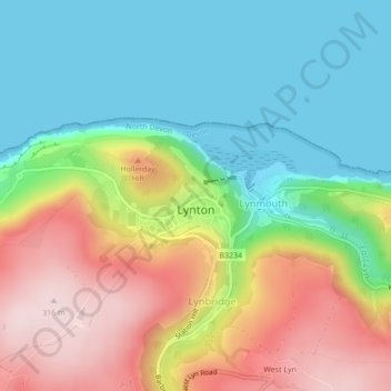
Name: Lynton topographic map, elevation, terrain.

Location: Lynton, Lynton and Lynmouth, Lynbridge, North Devon, Devon, Devon and Torbay, England, United Kingdom (51.22684 -3.84376 51.23381 -3.83213)

Average elevation: 124 m

Minimum elevation: 0 m

Maximum elevation: 317 m

Gear up for your next adventure:

🧣Evaporative Cooling Towel - Beat the heat during intense summer climbs
🧭GPS Outdoor Watch - Smart watch for navigation and fitness tracking in nature
Camping Tent - Weather-resistant tents suitable for 2 to 6 people
❄️Traction Ice Cleats - Slip-on spikes for icy trails and winter hiking
🔥Camping Stove - Portable stoves to cook outdoors with ease

As an Amazon Associate, this site earns from qualifying purchases at no extra cost to you.