Geolocate

Molland topographic map

Click on the map to display elevation.

About this map

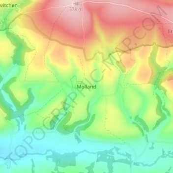
Name: Molland topographic map, elevation, terrain.

Location: Molland, North Devon, Devon, England, EX36 3NG, United Kingdom (51.02198 -3.71956 51.06198 -3.67956)

Average elevation: 225 m

Minimum elevation: 120 m

Maximum elevation: 371 m

Gear up for your next adventure:

🔭Compact Binoculars - Lightweight optics for scouting trails and wildlife
🔦LED Headtorch - Bright and durable light for night activities
Camping Coffee Maker - Brew fresh coffee anywhere on the topographic map
🔭Compact Monocular - One-handed bird watching and trail spotting
🥾Trekking Poles - Adjustable trekking poles to reduce knee stress and improve stability

As an Amazon Associate, this site earns from qualifying purchases at no extra cost to you.