

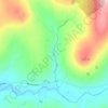
Dooish topographic map
Click on the map to display elevation.
About this map

Name: Dooish topographic map, elevation, terrain.
Average elevation: 161 m
Minimum elevation: 75 m
Maximum elevation: 337 m
Other topographic maps
Click on a map to view its topography, its elevation and its terrain.


Castlecaufield
United Kingdom > Northern Ireland > County Tyrone > Castlecaulfield
Average elevation: 95 m











Dungannon
United Kingdom > Northern Ireland > County Tyrone
The principal streets of the old town, Ann Street, Irish Street, Scotch Street, Church Street, Perry Street and Northland Row, retain most of their original buildings but in general, though with a significant number of individual exceptions, their character is being surely eroded by neglect or thoughtless…
Average elevation: 77 m