Geolocate

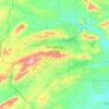
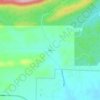
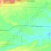
Lonsdale topographic map

Click on the map to display elevation.

About this map

Name: Lonsdale topographic map, elevation, terrain.

Location: Lonsdale, Garland County, Arkansas, 72087, United States (34.53983 -92.81825 34.54994 -92.80505)

Average elevation: 149 m

Minimum elevation: 121 m

Maximum elevation: 221 m

Other topographic maps

Click on a map to view its topography, its elevation and its terrain.
Royal

United States > Arkansas > Garland County

Average elevation: 160 m

Sunshine

United States > Arkansas > Garland County

Average elevation: 155 m

Pleasant Hill

United States > Arkansas > Garland County

Average elevation: 152 m

Bear

United States > Arkansas > Garland County

Average elevation: 216 m

Hot Springs National Park

United States > Arkansas > Garland County > Hot Springs

The National Park Service exercises no control or supervision over any matters connected with the city. The city starts on the other side of Central Avenue from Bathhouse Row. Its development has extended beyond the narrow valley in which the springs are located, spreading out over the open plain to the south…

Average elevation: 227 m

Jessieville

United States > Arkansas > Garland County

Average elevation: 238 m

Pearcy

United States > Arkansas > Garland County

Average elevation: 191 m

Gear up for your next adventure:

🛰️Satellite Messenger - Emergency communication for areas with no cell service
🧣Evaporative Cooling Towel - Beat the heat during intense summer climbs
🧦Merino Wool Socks - Moisture-wicking comfort for long-distance hiking
🧢Hiking Sun Hat - Wide-brimmed protection for exposed mountain ridges
💡Solar Camping Lamp - Eco-friendly lighting for campsites

As an Amazon Associate, this site earns from qualifying purchases at no extra cost to you.