Geolocate

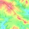
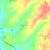
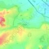
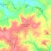
Lutterworth topographic map

Click on the map to display elevation.

About this map

Name: Lutterworth topographic map, elevation, terrain.

Location: Lutterworth, Harborough, Leicestershire, England, United Kingdom (52.43571 -1.25784 52.48292 -1.18129)

Average elevation: 125 m

Minimum elevation: 99 m

Maximum elevation: 146 m

Other topographic maps

Click on a map to view its topography, its elevation and its terrain.
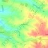
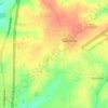
Tugby

United Kingdom > England > Leicestershire > Harborough

Average elevation: 158 m

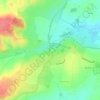
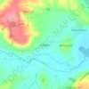
Shangton

United Kingdom > England > Leicestershire > Harborough

Average elevation: 127 m

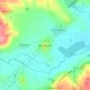
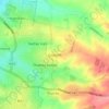
Thurnby

United Kingdom > England > Leicestershire > Harborough

Average elevation: 109 m

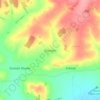
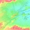
Kimcote

United Kingdom > England > Leicestershire > Harborough

Average elevation: 136 m

Shawell

United Kingdom > England > Leicestershire > Harborough > Shawell

Average elevation: 125 m

Slawston

United Kingdom > England > Leicestershire > Harborough

Average elevation: 92 m

Glooston

United Kingdom > England > Leicestershire > Harborough > Glooston

Average elevation: 117 m

Mowsley

United Kingdom > England > Leicestershire > Harborough

Average elevation: 147 m

Bushby

United Kingdom > England > Leicestershire > Harborough

Average elevation: 113 m

Saddington

United Kingdom > England > Leicestershire > Harborough

Average elevation: 126 m

Goadby

United Kingdom > England > Leicestershire > Harborough

Average elevation: 148 m

Rolleston

United Kingdom > England > Leicestershire > Harborough

Average elevation: 166 m

Gilmorton

United Kingdom > England > Leicestershire > Harborough

Average elevation: 136 m

Drayton

United Kingdom > England > Leicestershire > Harborough

Average elevation: 82 m

Scraptoft

United Kingdom > England > Leicestershire > Harborough

Average elevation: 103 m

Foxton

United Kingdom > England > Leicestershire > Harborough

Average elevation: 107 m

Bitteswell

United Kingdom > England > Leicestershire > Harborough

Average elevation: 128 m

Owston

United Kingdom > England > Leicestershire > Harborough

Average elevation: 169 m

High Cross

United Kingdom > England > Leicestershire > Harborough

Average elevation: 115 m

Gear up for your next adventure:

🕯️Camping Lantern - Illuminates your entire campsite with high-efficiency LEDs
🥾Trail Hiking Socks - Comfortable socks to prevent blisters and fatigue
🧢Sun Hat - Wide-brim hat for sun protection
🧴Insect Repellent - Protect yourself from bugs during outdoor adventures
🛌Down Sleeping Bag - Superior warmth-to-weight ratio for cold nights

As an Amazon Associate, this site earns from qualifying purchases at no extra cost to you.