Geolocate

Foulness Island topographic map

Click on the map to display elevation.

About this map

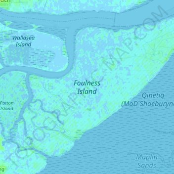
Name: Foulness Island topographic map, elevation, terrain.

Location: Foulness Island, Rochford, Essex, England, United Kingdom (51.55670 0.83278 51.62065 0.96003)

Average elevation: 1 m

Minimum elevation: -6 m

Maximum elevation: 9 m

Other topographic maps

Click on a map to view its topography, its elevation and its terrain.

Sutton

United Kingdom > England > Essex > Rochford

Average elevation: 11 m

Hawkwell

United Kingdom > England > Essex > Rochford

Average elevation: 32 m

Stroud Green

United Kingdom > England > Essex > Rochford

Average elevation: 22 m

Rawreth

United Kingdom > England > Essex > Rochford

Average elevation: 13 m

Great Stambridge

United Kingdom > England > Essex > Rochford

Average elevation: 8 m

Foulness Island

United Kingdom > England > Essex > Rochford

Average elevation: 1 m

Potash Woods

United Kingdom > England > Essex > Rochford > Hawkwell

Average elevation: 29 m

Battlesbridge

United Kingdom > England > Essex > Rochford > Battlesbridge

Average elevation: 15 m

Gear up for your next adventure:

🦟Insect Repellent - Keep mosquitoes and black flies away in wooded areas
🛶Canoe Life Vest - Safety vest for water sports
🧥Insulated Jacket - Keep warm in cold outdoor conditions
💧Hydration Bladder - Hands-free hydration solution for long treks
🔦LED Headlamp - Hands-free lighting for early morning starts or late finishes

As an Amazon Associate, this site earns from qualifying purchases at no extra cost to you.