Geolocate

Inchree topographic map

Click on the map to display elevation.

About this map

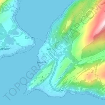
Name: Inchree topographic map, elevation, terrain.

Location: Inchree, Corran, Highland, Scotland, PH33 6SG, United Kingdom (56.69753 -5.24993 56.73753 -5.20993)

Average elevation: 68 m

Minimum elevation: 0 m

Maximum elevation: 434 m

Gear up for your next adventure:

🦶Anti-Blister Balm - Prevents friction and hotspots during long ascents
🧥Thermal Layer - Insulating layer for cold outdoor conditions
🥾Light Hiking Boots - Lightweight and comfortable boots for day hikes
🥾Trekking Poles - Adjustable trekking poles to reduce knee stress and improve stability
👖Convertible Hiking Pants - Zip-off legs to adapt to changing weather conditions

As an Amazon Associate, this site earns from qualifying purchases at no extra cost to you.