Geolocate

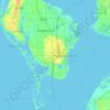
Indian Rocks Beach topographic map

Click on the map to display elevation.

About this map
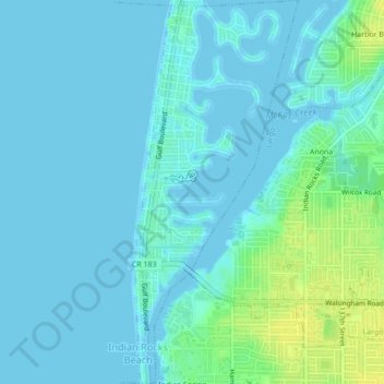
Name: Indian Rocks Beach topographic map, elevation, terrain.

Location: Indian Rocks Beach, Pinellas County, Florida, United States (27.87229 -82.85149 27.91030 -82.83323)

Average elevation: 4 m

Minimum elevation: -3 m

Maximum elevation: 19 m

Other topographic maps

Click on a map to view its topography, its elevation and its terrain.
Baskin

United States > Florida > Pinellas County > Largo

Average elevation: 14 m

Anona

United States > Florida > Pinellas County > Largo

Average elevation: 9 m

Gear up for your next adventure:

🔪Outdoor Multitool - Versatile tool for repairs and food prep in the wild
🔋Emergency Crank Radio - Weather alerts and power without needing batteries
⛺Tent Footprint - Protect tent floor and increase durability
👟Sport Hiking Sandals - Breathable footwear for water crossings and camp rest
⛺Lightweight Backpacking Tent - Compact tent for efficient hiking trips

As an Amazon Associate, this site earns from qualifying purchases at no extra cost to you.