Geolocate

Anona topographic map

Click on the map to display elevation.

About this map
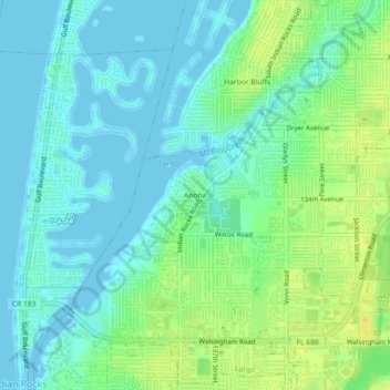
Name: Anona topographic map, elevation, terrain.

Location: Anona, Largo, Pinellas County, Florida, 33774, United States (27.87530 -82.85066 27.91530 -82.81066)

Average elevation: 9 m

Minimum elevation: -3 m

Maximum elevation: 24 m

Gear up for your next adventure:

🥾Waterproof Hiking Shoes - Durable shoes for wet and rugged trails
⛺Tent Footprint - Protect tent floor and increase durability
🧦Thermal Socks - Warm socks for winter hiking or camping
🥾Hiking Shorts - Breathable shorts suitable for summer hikes
🥾Lightweight Hiking Boots - Boots for comfort and mobility on long hikes

As an Amazon Associate, this site earns from qualifying purchases at no extra cost to you.