Geolocate

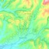
Poggio Corese topographic map

Click on the map to display elevation.

About this map

Name: Poggio Corese topographic map, elevation, terrain.

Location: Poggio Corese, Scandriglia, Rieti, Lazio, 00017, Italy (42.14859 12.76913 42.18859 12.80913)

Average elevation: 353 m

Minimum elevation: 196 m

Maximum elevation: 706 m

Other topographic maps

Click on a map to view its topography, its elevation and its terrain.

Poggio Mirteto

Italy > Lazio > Rieti

Average elevation: 278 m

Mompeo

Italy > Lazio > Rieti

Average elevation: 435 m

Longone Sabino

Italy > Lazio > Rieti

Average elevation: 712 m

Antrodoco

Italy > Lazio > Rieti

Average elevation: 1,041 m

Greccio

Italy > Lazio > Rieti

Average elevation: 704 m

Tarano

Italy > Lazio > Rieti

Average elevation: 186 m

Poggio Moiano

Italy > Lazio > Rieti

Average elevation: 601 m

Scandriglia

Italy > Lazio > Rieti

Average elevation: 605 m

Gear up for your next adventure:

🌬️Windproof Camp Stove - Efficient cooking even on exposed mountain peaks
👟Sport Hiking Sandals - Breathable footwear for water crossings and camp rest
💡Compact LED Flashlight - Powerful and portable flashlight for outdoor use
⛺Backpacking Tent - Lightweight tent for long-distance hiking trips
🧢Sun Hat - Wide-brim hat for sun protection

As an Amazon Associate, this site earns from qualifying purchases at no extra cost to you.