Geolocate

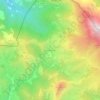
Burgos topographic map

Click on the map to display elevation.

About this map

Name: Burgos topographic map, elevation, terrain.

Location: Burgos, Castile and León, Spain (41.45078 -4.33534 43.19875 -2.51757)

Average elevation: 916 m

Minimum elevation: 88 m

Maximum elevation: 2,517 m

Other topographic maps

Click on a map to view its topography, its elevation and its terrain.
Camino de Santiago

Spain > Castile and León > Zazuar

Average elevation: 848 m

Filiel

Spain > Castile and León > Lucillo

Average elevation: 1,172 m

Mogote

Spain > Castile and León > Mijares

Average elevation: 1,079 m

Piedrasluengas

Spain > Castile and León > La Pernía

Average elevation: 1,383 m

La Corralina

Spain > Castile and León > Gema

Average elevation: 697 m

Los Ventorros

Spain > Castile and León > Terradillos

Average elevation: 845 m

Pastor

Spain > Castile and León > Navalonguilla

Average elevation: 1,770 m

La Nogada

Spain > Castile and León > Cardeñuela Riopico

Average elevation: 1,004 m

Chollas

Spain > Castile and León > Rosinos de la Requejada

Average elevation: 1,300 m

Peñafiel

Spain > Castile and León > Peñafiel > Peñafiel

Average elevation: 772 m

A Corona

Spain > Castile and León > El Bierzo > Candín

Average elevation: 985 m

El Durazno

Spain > Castile and León > Candeleda

Average elevation: 1,839 m

Gear up for your next adventure:

🥾Durable Hiking Shoes - Long-lasting shoes for frequent hiking
🧢Outdoor Visor - Breathable visor for sunny hikes
🧦Merino Wool Socks - Moisture-wicking comfort for long-distance hiking
👟Sport Hiking Sandals - Breathable footwear for water crossings and camp rest
🥾Hiking Boots - Sturdy boots providing ankle support and traction on rugged trails

As an Amazon Associate, this site earns from qualifying purchases at no extra cost to you.