Geolocate

Pastor topographic map

Click on the map to display elevation.

About this map

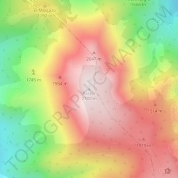
Name: Pastor topographic map, elevation, terrain.

Location: Pastor, Navalonguilla, Ávila, Castile and León, Spain (40.28307 -5.45898 40.28317 -5.45888)

Average elevation: 1,770 m

Minimum elevation: 1,367 m

Maximum elevation: 2,096 m

Gear up for your next adventure:

Camping Tent - Weather-resistant tents suitable for 2 to 6 people
🧤Insulated Winter Gloves - Heavy-duty protection for sub-zero Canadian adventures
🧭GPS Handheld Device - Reliable GPS navigation for outdoor adventures
🧴Sunscreen SPF - Broad-spectrum sunscreen for outdoor activities
💧Reusable Water Bottle - Durable water bottles for hydration on trails

As an Amazon Associate, this site earns from qualifying purchases at no extra cost to you.