Geolocate

Fortuna Foothills topographic map

Click on the map to display elevation.

About this map

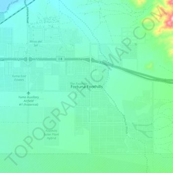
Name: Fortuna Foothills topographic map, elevation, terrain.

Location: Fortuna Foothills, Yuma County, Arizona, 85367, United States (32.61784 -114.45189 32.69784 -114.37189)

Average elevation: 113 m

Minimum elevation: 46 m

Maximum elevation: 424 m

Other topographic maps

Click on a map to view its topography, its elevation and its terrain.

Dateland

United States > Arizona > Yuma County

Average elevation: 134 m

Somerton

United States > Arizona > Yuma County

Average elevation: 33 m

Wellton

United States > Arizona > Yuma County

Average elevation: 97 m

Yuma

United States > Arizona > Yuma County

Average elevation: 56 m

Mittry Lake

United States > Arizona > Yuma County > Laguna

Average elevation: 58 m

San Luis

United States > Arizona > Yuma County

Average elevation: 36 m

Yuma

United States > Arizona > Yuma County

Average elevation: 56 m

Yuma

United States > Arizona > Yuma County

Average elevation: 56 m

Yuma

United States > Arizona > Yuma County

Average elevation: 56 m

Dateland

United States > Arizona > Yuma County

Average elevation: 134 m

Gear up for your next adventure:

🧢Outdoor Cap - Protective cap for sun and rain during hikes
🥾Waterproof Trail Shoes - Shoes designed to handle wet terrain
🧭GPS Outdoor Watch - Smart watch for navigation and fitness tracking in nature
Tent Footprint - Protect tent floor and increase durability
🦯Trekking Poles - Reduced impact on joints for steep topographic climbs

As an Amazon Associate, this site earns from qualifying purchases at no extra cost to you.