Geolocate

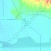
Combat Village topographic map

Click on the map to display elevation.

About this map

Name: Combat Village topographic map, elevation, terrain.

Location: Combat Village, Yuma County, Arizona, United States (32.52269 -113.96681 32.52780 -113.95716)

Average elevation: 286 m

Minimum elevation: 249 m

Maximum elevation: 422 m

Other topographic maps

Click on a map to view its topography, its elevation and its terrain.
Yuma

United States > Arizona > Yuma County

Average elevation: 69 m

Dateland

United States > Arizona > Yuma County

Average elevation: 134 m

Horn

United States > Arizona > Yuma County

Average elevation: 142 m

Buckshot

United States > Arizona > Yuma County

Average elevation: 52 m

Fortuna Foothills

United States > Arizona > Yuma County

Average elevation: 113 m

Kofa Butte

United States > Arizona > Yuma County

Average elevation: 687 m

Kofa

United States > Arizona > Yuma County

Average elevation: 118 m

Dateland

United States > Arizona > Yuma County

Average elevation: 134 m

Buckshot

United States > Arizona > Yuma County

Average elevation: 52 m

Tyson

United States > Arizona > Yuma County

Average elevation: 94 m

Fortuna Foothills

United States > Arizona > Yuma County

Average elevation: 113 m

Roll

United States > Arizona > Yuma County

Average elevation: 80 m

Gear up for your next adventure:

🥾Waterproof Hiking Boots - Boots keeping your feet dry in wet conditions
🛌Down Sleeping Bag - Superior warmth-to-weight ratio for cold nights
👟Trail Running Shoes - Agile footwear for fast-paced topographic exploration
🧤Rechargeable Heated Gloves - Extreme warmth for Canadian winter expeditions
💧Collapsible Water Bottle - Space-saving water bottle for outdoor activities

As an Amazon Associate, this site earns from qualifying purchases at no extra cost to you.