Geolocate

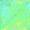
Linxu topographic map

Click on the map to display elevation.

About this map

Name: Linxu topographic map, elevation, terrain.

Location: Linxu, Nanning, Guangxi, China (23.48333 108.09106 23.56333 108.17106)

Average elevation: 247 m

Minimum elevation: 169 m

Maximum elevation: 480 m

Other topographic maps

Click on a map to view its topography, its elevation and its terrain.
Heng County

China > Guangxi > Nanning

Average elevation: 135 m

Qingxiu District

China > Guangxi > Nanning

Average elevation: 140 m

Xingning District

China > Guangxi > Nanning

Average elevation: 191 m

Liangqing

China > Guangxi > Nanning

Average elevation: 98 m

Long'an County

China > Guangxi > Nanning

Average elevation: 255 m

Yongning District

China > Guangxi > Nanning

Average elevation: 118 m

Gear up for your next adventure:

🛏️Sleeping Bag - Warm and compact sleeping bags for outdoor camping
🌬️Windproof Camp Stove - Efficient cooking even on exposed mountain peaks
🔋Lithium AA Batteries - Long-lasting power that performs in extreme cold
🍽️Titanium Camping Spork - Ultralight and indestructible eating utensil
🧭GPS Handheld Device - Reliable GPS navigation for outdoor adventures

As an Amazon Associate, this site earns from qualifying purchases at no extra cost to you.