Geolocate

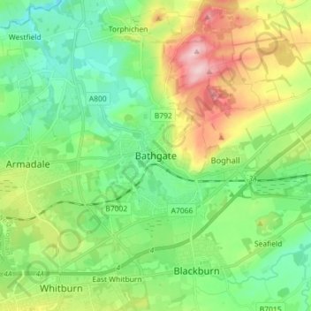
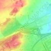
Bathgate topographic map

Click on the map to display elevation.

Bathgate

In the 1846 book A Topographical Dictionary of Scotland, Samuel Lewis writes.

Wikipedia (CC-BY-SA 3.0)

About this map

Name: Bathgate topographic map, elevation, terrain.

Location: Bathgate, West Lothian, Scotland, EH48 1PA, United Kingdom (55.86092 -3.68148 55.94092 -3.60148)

Average elevation: 167 m

Minimum elevation: 97 m

Maximum elevation: 311 m

Other topographic maps

Click on a map to view its topography, its elevation and its terrain.

Deans

United Kingdom > Scotland > West Lothian

Average elevation: 164 m

River Almond

United Kingdom > Scotland > West Lothian

Average elevation: 162 m

Dechmont

United Kingdom > Scotland > West Lothian

Average elevation: 155 m

Whispering Wood

United Kingdom > Scotland > West Lothian > Deans

Average elevation: 166 m

Gear up for your next adventure:

🥾Waterproof Hiking Boots - Essential footwear for rugged terrain and wet Canadian trails
🥾Hiking Shorts - Breathable shorts suitable for summer hikes
🥘Camping Cookware Set - Compact nesting pots and pans for trail cooking
🥾Waterproof Trail Shoes - Shoes designed to handle wet terrain
🎒Hiking Backpack - Lightweight and ergonomic backpacks for day hikes or multi-day treks

As an Amazon Associate, this site earns from qualifying purchases at no extra cost to you.