Geolocate

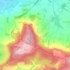
Nottingham Hill topographic map

Click on the map to display elevation.

About this map

Name: Nottingham Hill topographic map, elevation, terrain.

Location: Nottingham Hill, Tewkesbury, Gloucestershire, England, GL52 9AD, United Kingdom (51.95370 -2.02988 51.95380 -2.02978)

Average elevation: 157 m

Minimum elevation: 58 m

Maximum elevation: 297 m

Other topographic maps

Click on a map to view its topography, its elevation and its terrain.

Tirley

United Kingdom > England > Gloucestershire > Tewkesbury

Average elevation: 19 m

Snowshill

United Kingdom > England > Gloucestershire > Tewkesbury

Average elevation: 249 m

Prescott

United Kingdom > England > Gloucestershire > Tewkesbury

Average elevation: 148 m

Highnam

United Kingdom > England > Gloucestershire > Tewkesbury > Highnam

Average elevation: 21 m

Hawling

United Kingdom > England > Gloucestershire > Tewkesbury

Average elevation: 241 m

Gear up for your next adventure:

👟Trail Running Shoes - Agile footwear for fast-paced topographic exploration
🔦UV Flashlight - Detect minerals or specific insects in the dark
🥾Hiking Gaiters - Protect legs and shoes from mud, snow, and debris
🥾Waterproof Trail Shoes - Shoes designed to handle wet terrain
🥘Camping Cookware Set - Compact nesting pots and pans for trail cooking

As an Amazon Associate, this site earns from qualifying purchases at no extra cost to you.