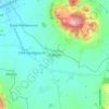
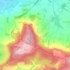
Hawling topographic map
Click on the map to display elevation.
About this map

Name: Hawling topographic map, elevation, terrain.
Location: Hawling, Tewkesbury, Gloucestershire, England, United Kingdom (51.88700 -1.92993 51.93578 -1.85362)
Average elevation: 241 m
Minimum elevation: 122 m
Maximum elevation: 300 m
Other topographic maps
Click on a map to view its topography, its elevation and its terrain.
Bishop's Cleeve
United Kingdom > England > Gloucestershire > Tewkesbury > Gotherington
Average elevation: 51 m
Coopers Hill Wood
United Kingdom > England > Gloucestershire > Tewkesbury > Witcombe > Cooper's Hill
Average elevation: 157 m