Geolocate

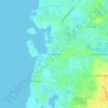
Redington Beach topographic map

Click on the map to display elevation.

About this map

Name: Redington Beach topographic map, elevation, terrain.

Location: Redington Beach, Pinellas County, Florida, United States (27.79822 -82.82690 27.82130 -82.79972)

Average elevation: 1 m

Minimum elevation: -2 m

Maximum elevation: 11 m

Other topographic maps

Click on a map to view its topography, its elevation and its terrain.
Baskin

United States > Florida > Pinellas County > Largo

Average elevation: 14 m

Anona

United States > Florida > Pinellas County > Largo

Average elevation: 9 m

Gear up for your next adventure:

🧢Sun Protection Cap - Breathable cap to protect from sun exposure
👟Trail Running Shoes - Agile footwear for fast-paced topographic exploration
🧦Outdoor Socks - Durable socks designed for hiking and outdoor sports
🧢Hiking Sun Hat - Wide-brimmed protection for exposed mountain ridges
⛺Backpacking Tent - Lightweight tent for long-distance hiking trips

As an Amazon Associate, this site earns from qualifying purchases at no extra cost to you.