Geolocate

Bowling Green topographic map

Click on the map to display elevation.

About this map
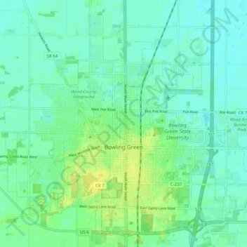
Name: Bowling Green topographic map, elevation, terrain.

Location: Bowling Green, Wood County, Ohio, United States (41.34884 -83.69860 41.41460 -83.59996)

Average elevation: 207 m

Minimum elevation: 201 m

Maximum elevation: 219 m

Other topographic maps

Click on a map to view its topography, its elevation and its terrain.

Cedar Creek Woods

United States > Ohio > Wood County > Northwood

Average elevation: 185 m

Sugar Ridge

United States > Ohio > Wood County

Average elevation: 203 m

Perry Center

United States > Ohio > Wood County

Average elevation: 223 m

Dowling

United States > Ohio > Wood County

Average elevation: 200 m

Westgate Homes

United States > Ohio > Wood County > Bowling Green

Average elevation: 210 m

Gear up for your next adventure:

🍽️Titanium Camping Spork - Ultralight and indestructible eating utensil
🛁Quick-Dry Microfiber Towel - Space-saving towel that dries rapidly on the move
🔭Outdoor Binoculars - Lightweight binoculars for birdwatching and hiking
🔋Emergency Crank Radio - Weather alerts and power without needing batteries
🧢Hiking Hat - Sun-protective and breathable hats for long treks

As an Amazon Associate, this site earns from qualifying purchases at no extra cost to you.