Geolocate

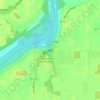
Dowling topographic map

Click on the map to display elevation.

About this map

Name: Dowling topographic map, elevation, terrain.

Location: Dowling, Wood County, Ohio, 43414, United States (41.45839 -83.61354 41.49839 -83.57354)

Average elevation: 200 m

Minimum elevation: 195 m

Maximum elevation: 211 m

Other topographic maps

Click on a map to view its topography, its elevation and its terrain.
Walbridge

United States > Ohio > Wood County

Average elevation: 190 m

Grand Rapids

United States > Ohio > Wood County

Average elevation: 201 m

Bowling Green

United States > Ohio > Wood County

Average elevation: 207 m

Jerry City

United States > Ohio > Wood County

Average elevation: 211 m

Perrysburg

United States > Ohio > Wood County

Average elevation: 194 m

Montgomery Township

United States > Ohio > Wood County

Average elevation: 211 m

Bowling Green

United States > Ohio > Wood County

Average elevation: 207 m

Cygnet

United States > Ohio > Wood County

Average elevation: 214 m

Rossford

United States > Ohio > Wood County

Average elevation: 191 m

Perrysburg

United States > Ohio > Wood County

Average elevation: 194 m

Pemberville

United States > Ohio > Wood County

Average elevation: 200 m

Bowling Green

United States > Ohio > Wood County

Average elevation: 207 m

Gear up for your next adventure:

🧦Hiking Liner Socks - Thin base layer to prevent friction and blisters
🪜Heavy Duty Carabiners - Multi-use clips for securing gear to your backpack
⛺Bushcraft Tarp - Versatile emergency shelter or gear protection
👟Leg Gaiters - Keep debris, mud, and snow out of your boots
🥾Trekking Boots - Durable boots for long-distance trekking

As an Amazon Associate, this site earns from qualifying purchases at no extra cost to you.