Geolocate

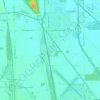
Sugar Ridge topographic map

Click on the map to display elevation.

About this map

Name: Sugar Ridge topographic map, elevation, terrain.

Location: Sugar Ridge, Center Township, Wood County, Ohio, 43414, United States (41.40894 -83.64243 41.44894 -83.60243)

Average elevation: 203 m

Minimum elevation: 198 m

Maximum elevation: 208 m

Other topographic maps

Click on a map to view its topography, its elevation and its terrain.

Grand Rapids

United States > Ohio > Wood County

Average elevation: 201 m

Bowling Green

United States > Ohio > Wood County

Average elevation: 207 m

Jerry City

United States > Ohio > Wood County

Average elevation: 211 m

Perrysburg

United States > Ohio > Wood County

Average elevation: 194 m

Walbridge

United States > Ohio > Wood County

Average elevation: 190 m

Montgomery Township

United States > Ohio > Wood County

Average elevation: 211 m

Bowling Green

United States > Ohio > Wood County

Average elevation: 207 m

Cygnet

United States > Ohio > Wood County

Average elevation: 214 m

Rossford

United States > Ohio > Wood County

Average elevation: 191 m

Perrysburg

United States > Ohio > Wood County

Average elevation: 194 m

Pemberville

United States > Ohio > Wood County

Average elevation: 200 m

Bowling Green

United States > Ohio > Wood County

Average elevation: 207 m

Gear up for your next adventure:

🧭Orienteering Kit - Tools for map reading and navigation in the wild
🦶Hiking Shoe Insoles - Added support for high arches and long days on feet
🦶Anti-Blister Balm - Prevents friction and hotspots during long ascents
💡Solar Camping Lamp - Eco-friendly lighting for campsites
🧤Rechargeable Heated Gloves - Extreme warmth for Canadian winter expeditions

As an Amazon Associate, this site earns from qualifying purchases at no extra cost to you.