Geolocate

Kirkton topographic map

Click on the map to display elevation.

About this map

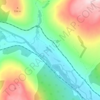
Name: Kirkton topographic map, elevation, terrain.

Location: Kirkton, Stirling, Scotland, FK20 8RU, United Kingdom (56.39936 -4.68065 56.43936 -4.64065)

Average elevation: 339 m

Minimum elevation: 152 m

Maximum elevation: 699 m

Gear up for your next adventure:

🔦LED Headlamp - Hands-free lighting for early morning starts or late finishes
🥾Hiking Shorts - Breathable shorts suitable for summer hikes
🧥Waterproof Jacket - Lightweight rain jackets for hiking and outdoor activities
🩹Compact First Aid Kit - Pre-packed essentials for common trail injuries
🎒Hiking Backpack - Lightweight and ergonomic backpacks for day hikes or multi-day treks

As an Amazon Associate, this site earns from qualifying purchases at no extra cost to you.