Geolocate

Band topographic map

Click on the map to display elevation.

About this map

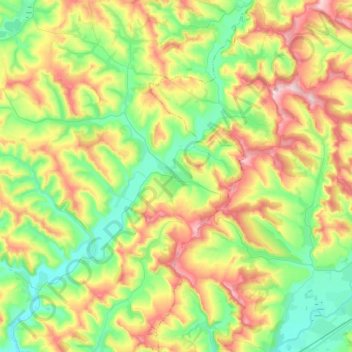
Name: Band topographic map, elevation, terrain.

Location: Band, Mureș, Romania (46.49157 24.27815 46.66802 24.42439)

Average elevation: 377 m

Minimum elevation: 285 m

Maximum elevation: 529 m

Other topographic maps

Click on a map to view its topography, its elevation and its terrain.

Eremieni

Romania > Mureș

Average elevation: 452 m

Transylvania

Romania > Mureș > Band

Average elevation: 648 m

Gear up for your next adventure:

🗺️Topographic Maps - Detailed maps to explore trails, mountains, and wilderness areas
🧥Softshell Hiking Jacket - The perfect balance of wind protection and breathability
💧Filtered Water Bottle - Safe drinking water on the go
🎒Hiking Backpack - Lightweight and ergonomic backpacks for day hikes or multi-day treks
🧢Outdoor Cap - Protective cap for sun and rain during hikes

As an Amazon Associate, this site earns from qualifying purchases at no extra cost to you.