Geolocate

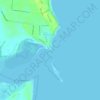
Qunaba topographic map

Click on the map to display elevation.

About this map

Name: Qunaba topographic map, elevation, terrain.

Location: Qunaba, Bundaberg Region, Queensland, Australia (-24.85774 152.40489 -24.79021 152.45555)

Average elevation: 19 m

Minimum elevation: 0 m

Maximum elevation: 95 m

Other topographic maps

Click on a map to view its topography, its elevation and its terrain.
Gin Gin

Australia > Queensland > Bundaberg Region > Gin Gin

Average elevation: 73 m

Burrum River

Australia > Queensland > Bundaberg Region > Buxton

Average elevation: 20 m

Bundaberg

Australia > Queensland > Bundaberg Region

Average elevation: 18 m

Bundaberg

Australia > Queensland > Bundaberg Region

Average elevation: 18 m

Gear up for your next adventure:

⛺Backpacking Tent - Lightweight tent for long-distance hiking trips
🎒Backpack Rain Cover - External shield to keep your entire pack dry
🔋Solar Power Bank - Keep your GPS and devices charged during long outdoor trips
🥾Light Hiking Boots - Lightweight and comfortable boots for day hikes
🧊Insulated Water Bottle - Keeps drinks cold in summer and prevents freezing in winter

As an Amazon Associate, this site earns from qualifying purchases at no extra cost to you.