

Loch Morar topographic map
Click on the map to display elevation.
Loch Morar
Loch Morar (Scottish Gaelic: Loch Mòrair) is a freshwater loch in Lochaber, Highland, Scotland. It is the fifth-largest loch by surface area in Scotland, at 26.7 km2 (10.3 sq mi), and the deepest freshwater body in the British Isles with a maximum depth of 310 m (1,017 ft). The loch was created by glacial action around 10,000 years ago, and has a surface elevation of 9 metres (30 ft) above sea level. It separates the traditional district of North Morar (which contains the village of Morar), from Arisaig and Moidart.
About this map
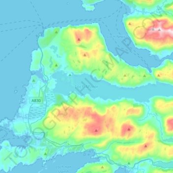
Name: Loch Morar topographic map, elevation, terrain.
Location: Loch Morar, Morar, Highland, Scotland, United Kingdom (56.94133 -5.80966 56.97220 -5.50604)
Average elevation: 118 m
Minimum elevation: -1 m
Maximum elevation: 780 m
Other topographic maps
Click on a map to view its topography, its elevation and its terrain.
