Geolocate

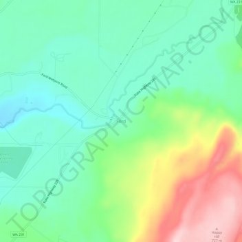
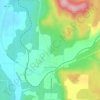
Ford topographic map

Click on the map to display elevation.

Ford

Ford is located in a mountainous area at the base of Happy Hill, which rises more than 600 feet immediately to the southeast of the community. The northeast–southwest trending Walkers Prairie and valley floor along which Chamokane Creek flows is relatively flat and at an elevation of between 1,700 and 1,800 feet above sea level in the vicinity of the community.

Wikipedia (CC-BY-SA 3.0)

About this map

Name: Ford topographic map, elevation, terrain.

Location: Ford, Stevens County, Washington, United States (47.88822 -117.82579 47.92822 -117.78579)

Average elevation: 577 m

Minimum elevation: 504 m

Maximum elevation: 731 m

Other topographic maps

Click on a map to view its topography, its elevation and its terrain.
Chewelah

United States > Washington > Stevens County

Average elevation: 590 m

Colville

United States > Washington > Stevens County

Average elevation: 559 m

Valley

United States > Washington > Stevens County > Valley

Average elevation: 555 m

Kettle Falls

United States > Washington > Stevens County

Average elevation: 508 m

Northport

United States > Washington > Stevens County

Average elevation: 502 m

Springdale

United States > Washington > Stevens County

Average elevation: 656 m

Addy

United States > Washington > Stevens County > Addy

Average elevation: 603 m

Loon Lake

United States > Washington > Stevens County

Average elevation: 779 m

Springdale

United States > Washington > Stevens County

Average elevation: 656 m

Kettle Falls

United States > Washington > Stevens County

Average elevation: 508 m

Northport

United States > Washington > Stevens County

Average elevation: 500 m

Valley

United States > Washington > Stevens County > Valley

Average elevation: 555 m

Loon Lake

United States > Washington > Stevens County

Average elevation: 779 m

Colville

United States > Washington > Stevens County

Average elevation: 559 m

Gear up for your next adventure:

🦶Anti-Blister Balm - Prevents friction and hotspots during long ascents
🚲MTB Frame Bag - Carry tools and maps directly on your bicycle frame
🕶️Polarized Sunglasses - Reduces glare from snow and water at high elevations
💡LED Camping Lantern - Illuminate your campsite with long-lasting lanterns
🥾Lightweight Hiking Shoes - Comfortable shoes for day hikes

As an Amazon Associate, this site earns from qualifying purchases at no extra cost to you.