Geolocate

Colville topographic map

Click on the map to display elevation.

About this map

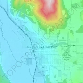
Name: Colville topographic map, elevation, terrain.

Location: Colville, Stevens County, Washington, United States (48.52959 -117.93649 48.56989 -117.86282)

Average elevation: 559 m

Minimum elevation: 468 m

Maximum elevation: 1,022 m

Other topographic maps

Click on a map to view its topography, its elevation and its terrain.

Gear up for your next adventure:

🧢Sun Hat - Wide-brim hat for sun protection
🥾Waterproof Hiking Shoes - Durable shoes for wet and rugged trails
🍽️Titanium Camping Spork - Ultralight and indestructible eating utensil
💧Filtered Water Bottle - Safe drinking water on the go
👟Sport Hiking Sandals - Breathable footwear for water crossings and camp rest

As an Amazon Associate, this site earns from qualifying purchases at no extra cost to you.