Geolocate

Addy topographic map

Click on the map to display elevation.

About this map

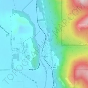
Name: Addy topographic map, elevation, terrain.

Location: Addy, Stevens County, Washington, United States (48.35212 -117.84424 48.36805 -117.83008)

Average elevation: 603 m

Minimum elevation: 486 m

Maximum elevation: 999 m

Gear up for your next adventure:

🧭GPS Handheld Device - Reliable GPS navigation for outdoor adventures
🛰️Satellite Messenger - Emergency communication for areas with no cell service
🔪Outdoor Multitool - Versatile tool for repairs and food prep in the wild
🥾Hiking Shoes - Durable and comfortable shoes for trail hiking
🎒Hiking Daypack - Lightweight and durable backpacks for day trips and excursions

As an Amazon Associate, this site earns from qualifying purchases at no extra cost to you.