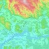
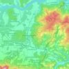
Petzen / Peca topographic map
Click on the map to display elevation.
Petzen / Peca
Petzen (German) or Peca (Slovene) is the highest mountain of the eastern Karawanks, the second-highest mountain of the Northern Karawanks and the most eastern two-thousand-metre mountain of Slovenia. It is a mighty mountain with a characteristic shape of a tableland with rocky peaks protruding from it. The mountain borders the Meža Valley and the Topla Valley to the south and east, and the Jaun Valley to the north, and is separated by the narrow valley of the Bela Creek from Hochobir. Two thirds of the mountain lies in Austria, and one third in Slovenia. The mountain reaches its highest elevation on the mountain crest of the Kordež Head (Slovene: Kordeževa Glava, German: Kordeschkopf, 2,125 metres or 6,972 feet). The border runs across it.
About this map

Name: Petzen / Peca topographic map, elevation, terrain.
Location: Petzen / Peca, Bezirk Völkermarkt, Carinthia, Austria (46.45820 14.58126 46.55862 14.87308)
Average elevation: 911 m
Minimum elevation: 440 m
Maximum elevation: 2,098 m
Other topographic maps
Click on a map to view its topography, its elevation and its terrain.

Bleiburg
Austria > Carinthia > Bezirk Völkermarkt
In December 2005, the Constitutional Court of Austria ruled that the topographic sign at the entrance to the town of Bleiburg was unconstitutional, since it was written only in German, and ordered the erection of a bilingual, German-Slovene sign. In February 2006, the Carinthian governor Jörg Haider made a…
Average elevation: 596 m