

Bleiburg topographic map
Click on the map to display elevation.
Bleiburg
In December 2005, the Constitutional Court of Austria ruled that the topographic sign at the entrance to the town of Bleiburg was unconstitutional, since it was written only in German, and ordered the erection of a bilingual, German-Slovene sign. In February 2006, the Carinthian governor Jörg Haider made a great stir by personally moving the German sign for a few meters, hoping to create a new legal situation that would require a new decision of the Constitutional Court.
About this map
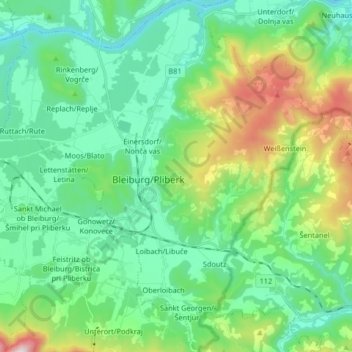
Name: Bleiburg topographic map, elevation, terrain.
Location: Bleiburg, Bezirk Völkermarkt, Carinthia, 9150, Austria (46.53454 14.73123 46.64767 14.88042)
Average elevation: 596 m
Minimum elevation: 357 m
Maximum elevation: 1,319 m