Geolocate

Straiton topographic map

Click on the map to display elevation.

About this map
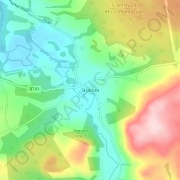
Name: Straiton topographic map, elevation, terrain.

Location: Straiton, South Ayrshire, Scotland, KA19 7NF, United Kingdom (55.29145 -4.57206 55.33145 -4.53206)

Average elevation: 186 m

Minimum elevation: 94 m

Maximum elevation: 350 m

Other topographic maps

Click on a map to view its topography, its elevation and its terrain.

Gear up for your next adventure:

🧥Waterproof Pants - Keep dry during rainy hiking conditions
🧥Ultralight Puffy Jacket - Maximum warmth that packs down to the size of an orange
🥾Mountain Hiking Boots - High-traction boots for rocky terrain
🧶550 Survival Paracord - Versatile utility cord for emergency repairs and rigging
💧Reusable Water Bottle - Durable water bottles for hydration on trails

As an Amazon Associate, this site earns from qualifying purchases at no extra cost to you.