Geolocate

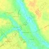
Hartsville topographic map

Click on the map to display elevation.

About this map

Name: Hartsville topographic map, elevation, terrain.

Location: Hartsville, Darlington County, South Carolina, 29550, United States (34.33955 -80.12532 34.39506 -80.04374)

Average elevation: 65 m

Minimum elevation: 43 m

Maximum elevation: 101 m

Other topographic maps

Click on a map to view its topography, its elevation and its terrain.

Gear up for your next adventure:

🥾Trekking Boots - Durable boots for long-distance trekking
💡Portable Camping Lamp - Rechargeable lamp for campsite lighting
👖Convertible Hiking Pants - Zip-off legs to adapt to changing weather conditions
🧤Rechargeable Heated Gloves - Extreme warmth for Canadian winter expeditions
🧢Sun Hat - Wide-brim hat for sun protection

As an Amazon Associate, this site earns from qualifying purchases at no extra cost to you.