Geolocate

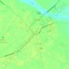
Kingsville Heights topographic map

Click on the map to display elevation.

About this map

Name: Kingsville Heights topographic map, elevation, terrain.

Location: Kingsville Heights, Darlington County, South Carolina, 29550, United States (34.32043 -80.09646 34.36043 -80.05646)

Average elevation: 66 m

Minimum elevation: 59 m

Maximum elevation: 71 m

Other topographic maps

Click on a map to view its topography, its elevation and its terrain.

Gear up for your next adventure:

🥾Mountain Hiking Shoes - Shoes with superior grip for mountainous terrain
🦯Trekking Poles - Reduced impact on joints for steep topographic climbs
💡Portable Camping Lamp - Rechargeable lamp for campsite lighting
🪑Ultralight Camping Stool - Compact seating for rest stops during long hikes
💧Hydration Bladder - Hands-free hydration solution for long treks

As an Amazon Associate, this site earns from qualifying purchases at no extra cost to you.