Geolocate

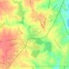
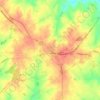
Shadow Wood topographic map

Click on the map to display elevation.

About this map

Name: Shadow Wood topographic map, elevation, terrain.

Location: Shadow Wood, Anderson County, South Carolina, United States (34.54955 -82.84403 34.58955 -82.80403)

Average elevation: 222 m

Minimum elevation: 197 m

Maximum elevation: 254 m

Other topographic maps

Click on a map to view its topography, its elevation and its terrain.
Belton

United States > South Carolina > Anderson County

Average elevation: 257 m

Iva

United States > South Carolina > Anderson County

Average elevation: 210 m

Starr

United States > South Carolina > Anderson County

Average elevation: 227 m

Pelzer

United States > South Carolina > Anderson County

Average elevation: 239 m

Pelzer

United States > South Carolina > Anderson County

Average elevation: 239 m

Starr

United States > South Carolina > Anderson County

Average elevation: 227 m

Pelzer

United States > South Carolina > Anderson County

Average elevation: 239 m

Belton

United States > South Carolina > Anderson County

Average elevation: 257 m

Gear up for your next adventure:

🎒Fully Waterproof Backpack - Total protection for photography gear and electronics
🧢Sun Hat - Wide-brim hat for sun protection
🧭GPS Outdoor Watch - Smart watch for navigation and fitness tracking in nature
🧼Biodegradable Camp Soap - Environmentally friendly cleaning for gear and body
🔭Outdoor Binoculars - Lightweight binoculars for birdwatching and hiking

As an Amazon Associate, this site earns from qualifying purchases at no extra cost to you.