Geolocate

Shimen County topographic map

Click on the map to display elevation.

About this map

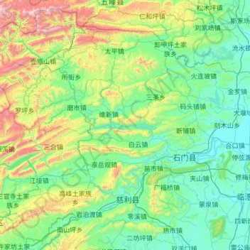
Name: Shimen County topographic map, elevation, terrain.

Location: Shimen County, Changde, Hunan, China (29.27353 110.48688 30.12843 111.53782)

Average elevation: 407 m

Minimum elevation: 37 m

Maximum elevation: 2,038 m

Other topographic maps

Click on a map to view its topography, its elevation and its terrain.

Xinpu

China > Hunan > Changde

Average elevation: 259 m

Gear up for your next adventure:

🧳Compression Sacks - Maximize space in your backpack by shrinking gear
🧴Sunscreen SPF - Broad-spectrum sunscreen for outdoor activities
🧦Merino Wool Socks - Moisture-wicking comfort for long-distance hiking
🧴Waterproofing Spray - Restore the DWR coating on jackets and tents
🧰Survival Kit - Essential gear for emergencies in the wilderness

As an Amazon Associate, this site earns from qualifying purchases at no extra cost to you.