Geolocate

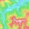
Kravenik topographic map

Click on the map to display elevation.

About this map

Name: Kravenik topographic map, elevation, terrain.

Location: Kravenik, Sevlievo, Gabrovo, Bulgaria (42.74590 24.96223 42.89400 25.06994)

Average elevation: 830 m

Minimum elevation: 305 m

Maximum elevation: 1,969 m

Other topographic maps

Click on a map to view its topography, its elevation and its terrain.

Valevtsi

Bulgaria > Gabrovo

Average elevation: 579 m

Kastel

Bulgaria > Gabrovo

Average elevation: 355 m

Koychovtsi

Bulgaria > Gabrovo > Tryavna

Average elevation: 568 m

Gear up for your next adventure:

🧢Hiking Hat - Sun-protective and breathable hats for long treks
🔦LED Headtorch - Bright and durable light for night activities
🔨Vehicle Emergency Tool - Safety tool for remote road trips to trailheads
🛏️Camping Sleeping Mat - Comfortable mats for sleeping outdoors
👖Convertible Hiking Pants - Zip-off legs to adapt to changing weather conditions

As an Amazon Associate, this site earns from qualifying purchases at no extra cost to you.