Geolocate

Koychovtsi topographic map

Click on the map to display elevation.

About this map

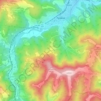
Name: Koychovtsi topographic map, elevation, terrain.

Location: Koychovtsi, Tryavna, Triavna, Gabrovo, 5350, Bulgaria (42.83450 25.46701 42.87450 25.50701)

Average elevation: 568 m

Minimum elevation: 424 m

Maximum elevation: 756 m

Gear up for your next adventure:

🦟Insect Repellent - Keep mosquitoes and black flies away in wooded areas
Camping Tent - Weather-resistant tents suitable for 2 to 6 people
🧰Multitool Knife - Compact and versatile tool for outdoor use
❄️Traction Ice Cleats - Slip-on spikes for icy trails and winter hiking
Lightweight Backpacking Tent - Compact tent for efficient hiking trips

As an Amazon Associate, this site earns from qualifying purchases at no extra cost to you.