Geolocate

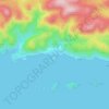
Drače topographic map

Click on the map to display elevation.

About this map

Name: Drače topographic map, elevation, terrain.

Location: Drače, Općina Janjina, Dubrovnik-Neretva County, Croatia (42.91309 17.43768 42.93900 17.47078)

Average elevation: 37 m

Minimum elevation: -1 m

Maximum elevation: 151 m

Other topographic maps

Click on a map to view its topography, its elevation and its terrain.
Gradina

Croatia > Dubrovnik-Neretva County

Average elevation: 28 m

Bosanka

Croatia > Dubrovnik-Neretva County > Dubrovnik

Average elevation: 156 m

Nuga

Croatia > Dubrovnik-Neretva County > Borovci

Average elevation: 173 m

Obalj

Croatia > Dubrovnik-Neretva County > Dubrovnik

Average elevation: 376 m

Orašac

Croatia > Dubrovnik-Neretva County > Dubrovnik

Average elevation: 115 m

Matijevići

Croatia > Dubrovnik-Neretva County

Average elevation: 49 m

Katani

Croatia > Dubrovnik-Neretva County > Babino Polje

Average elevation: 224 m

Lenga

Croatia > Dubrovnik-Neretva County > Lovište

Average elevation: 5 m

Radalj

Croatia > Dubrovnik-Neretva County > Klek

Average elevation: 100 m

Prijevor

Croatia > Dubrovnik-Neretva County > Dubrovnik

Average elevation: 248 m

Prižba

Croatia > Dubrovnik-Neretva County

Average elevation: 88 m

Tršić

Croatia > Dubrovnik-Neretva County > Ošlje

Average elevation: 405 m

Gear up for your next adventure:

💡Compact LED Flashlight - Powerful and portable flashlight for outdoor use
🥾Trail Running Shoes - Lightweight and durable shoes for trail running
🥘Camping Cookware Set - Compact nesting pots and pans for trail cooking
🛶Kayak Dry Bag - Waterproof storage for kayaking adventures
🔪Outdoor Multitool - Versatile tool for repairs and food prep in the wild

As an Amazon Associate, this site earns from qualifying purchases at no extra cost to you.